


 Pin
Pin Photo by NASA
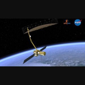
High above our planet, a revolutionary eye is preparing to watch over Earth like never before. The NISAR Satellite stands as one of the most ambitious Earth observation missions ever conceived, born from an unprecedented collaboration between NASA and the Indian Space Research Organisation (ISRO). This isn’t just another satellite floating in space—it’s a technological marvel that will reshape our understanding of our dynamic planet.
At its core, NISAR represents a fusion of cutting-edge radar technology and scientific ambition. The mission combines two powerful radar systems that can peer through clouds, darkness, and atmospheric interference to capture incredibly detailed images of Earth’s surface. Unlike traditional optical satellites that rely on sunlight and clear skies, this advanced system works around the clock, gathering data regardless of weather conditions or time of day.
The scale of this undertaking is staggering. Years of meticulous planning, international cooperation, and technological innovation have culminated in a satellite that weighs nearly 2,800 kilograms and carries some of the most sophisticated radar equipment ever launched into space. Every component has been designed to operate flawlessly in the harsh environment of space while delivering scientific data that will benefit humanity for years to come.
Table of Contents
The Technology Behind the Magic
Behind NISAR’s impressive capabilities lies a remarkable feat of engineering that pushes the boundaries of what’s possible in space technology. The satellite carries two distinct radar systems working in perfect harmony: NASA’s L-band radar and ISRO’s S-band radar. These systems operate on different frequencies, allowing scientists to capture complementary data that provides a complete picture of Earth’s surface changes with millimeter-level precision.
The magic happens through a technique called interferometric synthetic aperture radar, or InSAR for short. This sophisticated process compares radar images taken at different times to detect even the tiniest movements on Earth’s surface. Think of it as creating a time-lapse movie of our planet’s subtle shifts—landslides creeping down mountainsides, glaciers slowly retreating, or ground subsiding in urban areas become visible with stunning clarity.
What makes this technology truly revolutionary is its ability to measure changes across vast areas simultaneously. While traditional ground-based monitoring might cover a few square kilometers, NISAR can survey entire continents in a single pass. The satellite’s 12-meter-long reflector antenna, one of the largest ever deployed in space, ensures that no detail is too small to escape notice, making it an invaluable tool for understanding our rapidly changing world.
Monitoring Our Restless Planet
Earth is constantly in motion, though most of these changes happen too slowly or subtly for us to notice in our daily lives. NISAR will serve as our planetary stethoscope, listening to the heartbeat of geological processes that shape our world. The mission will track earthquakes as they build tension along fault lines, monitor volcanic activity that could threaten millions of people, and observe how massive ice sheets respond to our warming climate.
One of the most critical applications lies in understanding natural disasters before they strike. By continuously monitoring ground deformation, NISAR can detect the warning signs of landslides weeks or even months in advance. This early warning capability could save countless lives in vulnerable communities around the world, particularly in mountainous regions where millions live under the constant threat of unstable slopes.
The satellite will also revolutionize our understanding of water resources, tracking how groundwater levels change across different seasons and years. In regions facing severe drought or water scarcity, this information becomes invaluable for managing precious water supplies. Farmers, city planners, and government officials will gain unprecedented insights into how water moves through the landscape, helping them make informed decisions about sustainable development and resource allocation.
Climate Change Detective Work
As our planet grapples with an accelerating climate crisis, NISAR emerges as a crucial detective in understanding how rapidly our environment is transforming. The mission will provide scientists with an unprecedented view of ice sheet dynamics, measuring how quickly glaciers are melting and contributing to rising sea levels. Every centimeter of ice loss matters when billions of people live in coastal areas vulnerable to flooding.
The satellite’s keen eye will also track changes in vegetation patterns across the globe, revealing how forests respond to shifting weather patterns and human activities. These observations help scientists understand carbon cycles better—crucial information for predicting future climate scenarios. When vast boreal forests in Canada or Siberia experience sudden changes, NISAR will capture these shifts with remarkable detail, providing early indicators of ecosystem stress.
Perhaps most importantly, NISAR will help separate natural climate variations from human-induced changes. By building a comprehensive database of Earth’s surface movements over several years, researchers can identify patterns that might otherwise remain hidden. This long-term perspective becomes essential for developing effective climate adaptation strategies and understanding which regions face the greatest risks in the coming decades.
A Partnership That Reaches for the Stars
The collaboration between NASA and ISRO represents more than just shared technology—it embodies the spirit of international cooperation in addressing global challenges. This partnership brings together American expertise in L-band radar systems with India’s advanced S-band capabilities, creating a mission that neither country could have achieved alone. The result is a perfect example of how space exploration thrives when nations unite their strengths and resources.
Building NISAR required years of careful coordination across two continents, with engineers and scientists working together despite different time zones, languages, and technical approaches. The satellite’s components traveled thousands of miles between facilities in California and Bangalore, with each piece meticulously tested and integrated. This complex dance of international logistics demonstrates how modern space missions transcend national boundaries to serve humanity’s collective interests.
The success of this partnership opens doors for future collaborations that could tackle even more ambitious projects. As both NASA and ISRO continue pushing the boundaries of space technology, their joint experience with NISAR provides a proven framework for international cooperation. This mission proves that when countries pool their scientific expertise and resources, they can achieve remarkable feats that benefit people everywhere, regardless of nationality or politics.
Looking Toward Tomorrow
As NISAR prepares for its journey into orbit, the scientific community buzzes with anticipation about the discoveries that await. The mission promises to generate an enormous treasure trove of data—so much information that it will keep researchers busy for decades to come. Each day of operation will produce terabytes of precise measurements, creating the most comprehensive record of Earth’s surface changes ever assembled.
The real impact of this mission will unfold gradually as scientists analyze the continuous stream of data flowing back to Earth. Universities around the world are already preparing their research programs to dive into NISAR’s observations, training the next generation of Earth scientists who will grow up with this incredible resource at their fingertips. The mission will likely inspire breakthroughs we can’t even envision today, much like previous space missions revolutionized our understanding in unexpected ways.
Beyond the immediate scientific benefits, NISAR represents hope for a future where technology serves humanity’s greatest challenges. In an era of increasing environmental uncertainty, having such a powerful tool for monitoring our planet offers both reassurance and responsibility. The satellite reminds us that when we combine human ingenuity with international cooperation, we can create solutions that help protect the only home we have—our precious Earth.
FAQs
NISAR stands for NASA-ISRO Synthetic Aperture Radar. It’s a joint Earth observation mission between NASA and India’s space agency that uses advanced radar technology to monitor our planet’s surface changes with incredible precision.
The total mission cost is approximately $1.5 billion, shared between NASA and ISRO. This investment covers satellite development, launch, and three years of operations to gather unprecedented Earth monitoring data.
NISAR is scheduled to launch in 2024 aboard an ISRO rocket from India. Once operational, it will orbit Earth every 12 days, providing comprehensive global coverage of surface changes and natural phenomena.
NISAR can detect ground movements as small as a few millimeters using dual-frequency radar that works day and night through clouds. It monitors earthquakes, landslides, ice melting, and forest changes with unmatched accuracy.
NISAR tracks ice sheet melting, sea level rise, and vegetation changes caused by climate change. Its precise measurements help scientists understand how fast our planet is changing and predict future environmental impacts.